


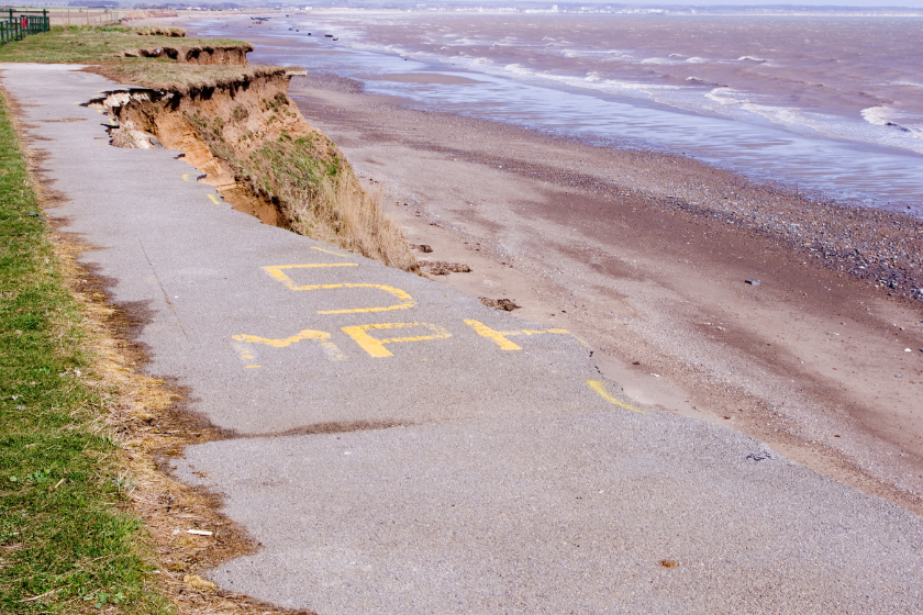
The latest coastal erosion data for the East Riding shows some of the highest levels of erosion ever recorded.
The data comes from a survey carried out in May and used LiDAR data to measure changes in the cliff line
Coastal Change Manager - Richard Jackson - erosion rates along the East Riding coastline were above average in many locations.
Richard Jackson, Coastal Change Manager, reported that the period between the August 2023 and May 2024 surveys was longer than usual (10 months compared to the usual 6 months) due to weather and tidal conditions. This longer interval, combined with an exceptionally wet and stormy winter, likely contributed to the higher than average erosion rates observed.
Several locations experienced particularly significant losses:
- Between Fraisthorpe and Barmston, erosion reached 4-5 metres in some places, compared to the average rate of just over 1 metre per year.
- At Skipsea to Ulrome, large individual losses of up to 8 metres were recorded, significantly higher than the usual 0.83 metre average.
- At Hornsea to Cowden, erosion reached up to 9 metres, with high erosion rates observed across the entire frontage. The average rate in this area is 2.3 metres per year.
- Between Holmpton and Tunstall, losses of up to 12 metres were recorded in an area with an average erosion rate of 1.3 metres per year.
The survey also identified a number of 500-metre stretches along the coast that experienced their highest ever recorded erosion losses.
Based on these findings, the Council expects 102 residential properties to be lost by 2105. Bur Richard Jackson warns that these figures do not include an allowance for climate change, which is anticipated to increase erosion rates further.
The Environment Agency is currently updating its national coastal erosion risk mapping (NCERM2), which is expected to be published in early 2025.
The new maps will incorporate updated climate change data and erosion data provided by local authorities, including the East Riding of Yorkshire Council. The maps will show predicted cliff lines up to 2105 under three different climate change scenarios.
The Council expects that the inclusion of climate change data will result in a significant increase in the projected number of properties and assets at risk from erosion.

 Bridlington Could Have One Large GP Practice for Entire Town
 Children's Online Safety Knowledge Improves but Risks Remain Says North Yorkshire Survey
 Former Scarborough Athletic Chairman Expresses Confidence in Ground Issue Resolution
 Esk Valley Community Railway Backs Train Use for Whitby School Pupils
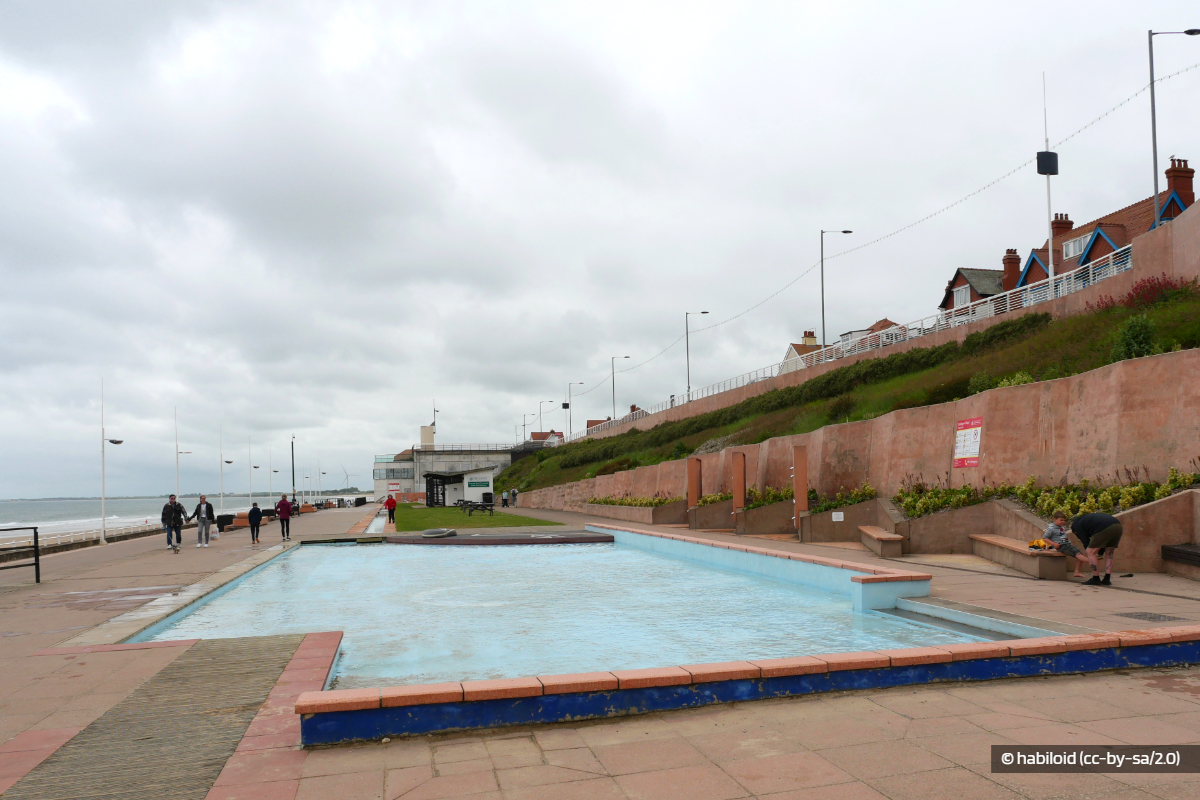 Concern Over Bridlington Paddling Pool Use
 Scarborough and Whitby MP Raises Concerns Over PIP Changes at Prime Minister's Questions
 Yorkshire Coast Towns Could Get Share of £1.2m Investment
 Scarborough Charity's Future Fears
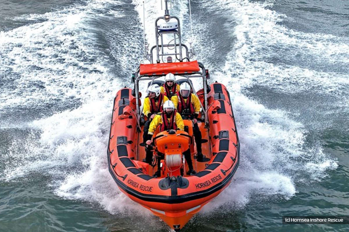 Hornsea Lifeboat Member Among London Marathon Runners
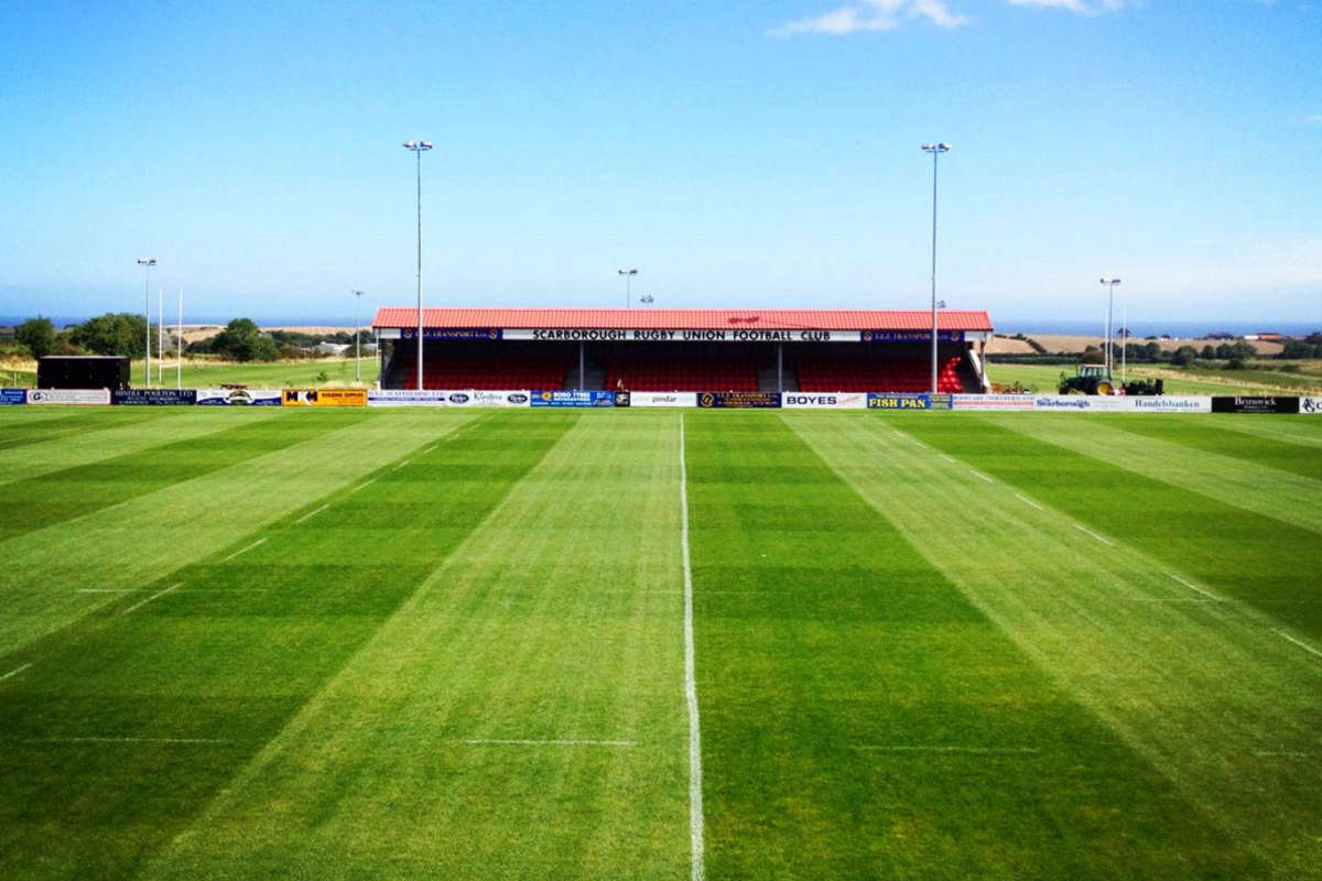 Scarborough Rugby's Cup Progress
 Mixed Results For Yorkshire Coast Cricket Sides
 Scarborough Athletic Miss Out On Top Half Spot


Comments
Add a comment