


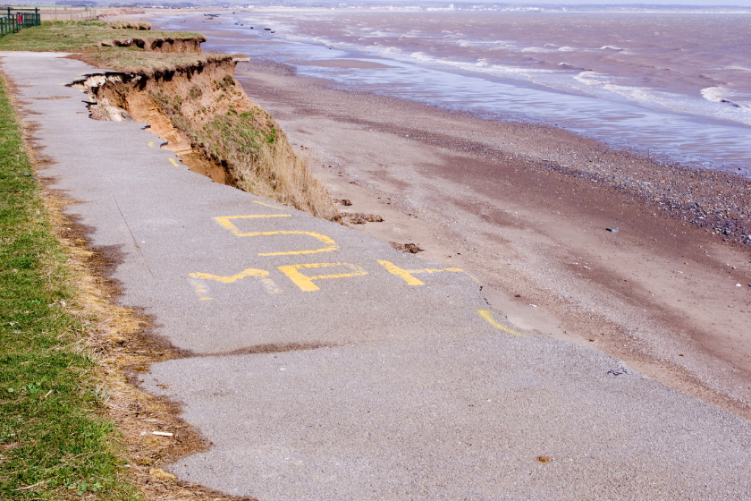
Following updated coastal erosion rate projections from the Environment Agency, the East Riding of Yorkshire Council is requesting an urgent meeting with the Minister to discuss support for affected communities
Council leader, Councillor Anne Handley, put forward the motion in light of the "devastating news" delivered by the Environment Agency regarding updated prospective coastal erosion rates, which will have an immediate impact on the future plans of many residents.
The Environment Agency's new National Coastal Erosion Risk Map (NCERM) offers an updated view of coastal erosion risk in England. The NCERM is based on coastal monitoring data from the National Network of Regional Coastal Monitoring Programmes and accounts for UKCP18 climate projections, including allowances for sea level rise. The projections in the NCERM extend to mid-century (2055) and the end of the century (2105) and reflects the latest coastal management approaches outlined in Shoreline Management Plans (SMPs).
The new NCERM shows that approximately 3,500 properties around the UK are at risk of coastal erosion by 2055, and this number is expected to rise to about 10,100 properties by 2105. These figures assume that funding and implementation of all actions in the SMPs are delivered. However, if SMPs are not delivered, the number of properties at risk could increase significantly, potentially reaching 32,800 by 2055. Even with SMPs in place, approximately 19,700 properties could be at risk by the end of the century, accounting for climate change. Without SMPs, this figure could be five times greater.
Yorkshire and The Humber, the South West, and the East of England have the highest numbers of properties at risk. East Riding of Yorkshire, along with North Norfolk and Cornwall, contains two-thirds of all residential properties in areas at risk of coastal erosion in England. These local authorities are part of the £36 million Coastal Transition Accelerator Programme (CTAP), which explores how coastal communities and businesses can adapt to the effects of erosion and climate change
Councillor Handley says the impact on the East Riding will be significant.
The Environment Agency says there are several reasons for the changes in risk assessment:
- Improved coastal analysis techniques are being used to assess coastal erosion at approximately 8,000 locations along the coast.
- The Environment Agency is using an additional 10 years of coastal monitoring data from the National Network of Regional Coastal Monitoring Programmes.
- There is updated information on the condition of coastal defences, including improved methods for estimating the chances and impacts of defence failure.
- Better information is available on a wider range of properties at erosion risk in coastal locations, including caravans, tourist, leisure, and business properties.
A meeting of full council backed Councillor Handley's motion, the authority will now seek a meeting with the government minister to discuss what support will be considered and given to affected communities moving forward.

 Five Star Seadogs! Scarborough Secure Important Win In Style
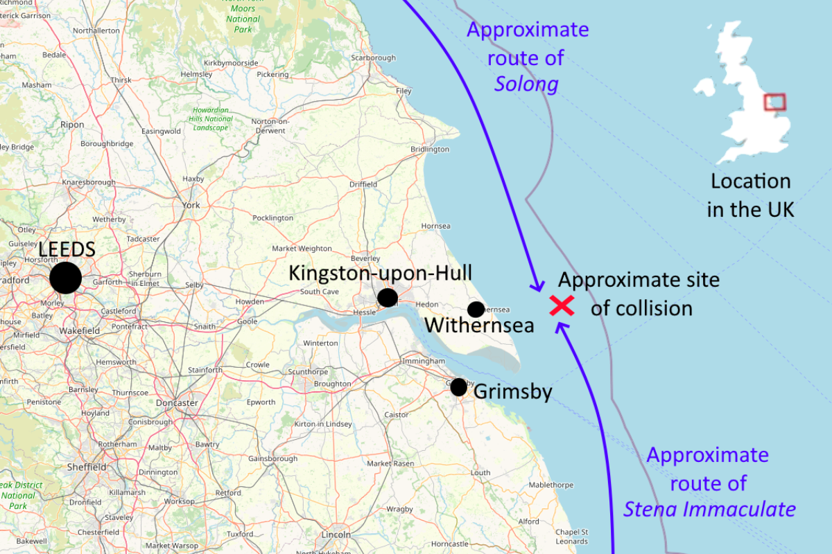
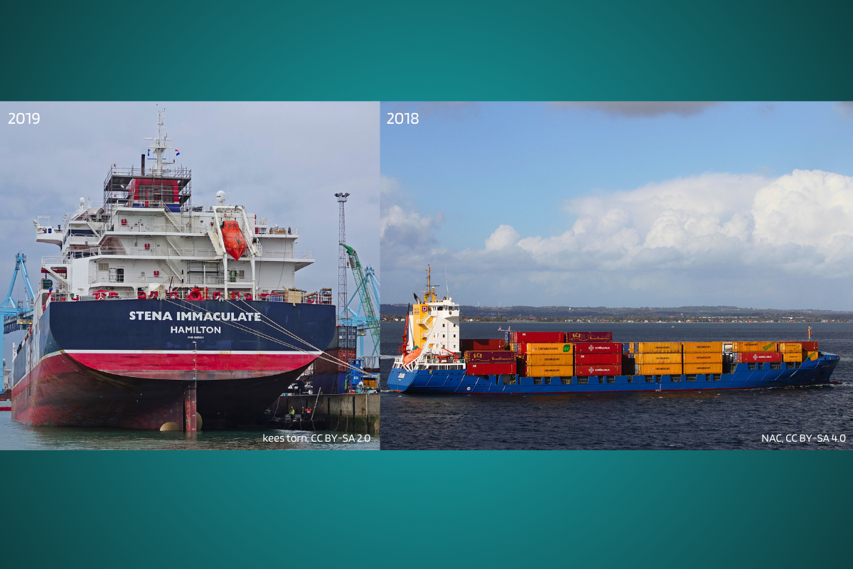 Arrest Over Yorkshire Coast Ship Collision
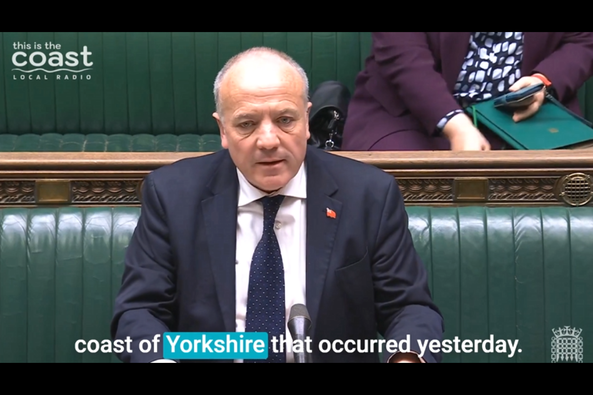 Minister Provides Update on Yorkshire Coast Shipping Collision
 Concerns for Yorkshire Coast Wildlife After Tanker Collision
 Man Charged with Murder After Incident in Scarborough
 Campaigners Plan Burniston “March Against the Gas Field”
 Boro Face "Massive" Home Clash Tonight
 Investigation After Man Arrested Over Knife Incident Near Scarborough
 North Yorkshire Taxi Drivers Urge Council to do More Research Ahead of Policy Change
 Bridlington RNLI Responds to Tanker Collision off East Yorkshire Coast
 Yorkshire Coast Health Study Could Influence National Health Policy


Comments
Add a comment